Weather Blog
To view our older weather blog posts, please click here
Weather Blog
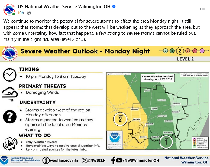
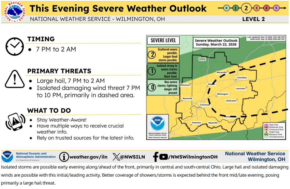
Severe weather possible Monday night
APR 26, 2026
Near Normal conditions at Cheviot OH 3.4W.
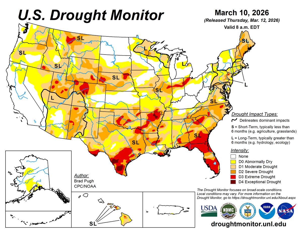
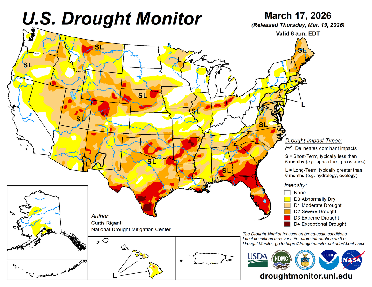
Widespread dry and drought conditions in the US, including the southwest, the south, the southeast and Florida, the east coast, New England, the central pl...
March 2026 Weather Summary
APR 9, 2026
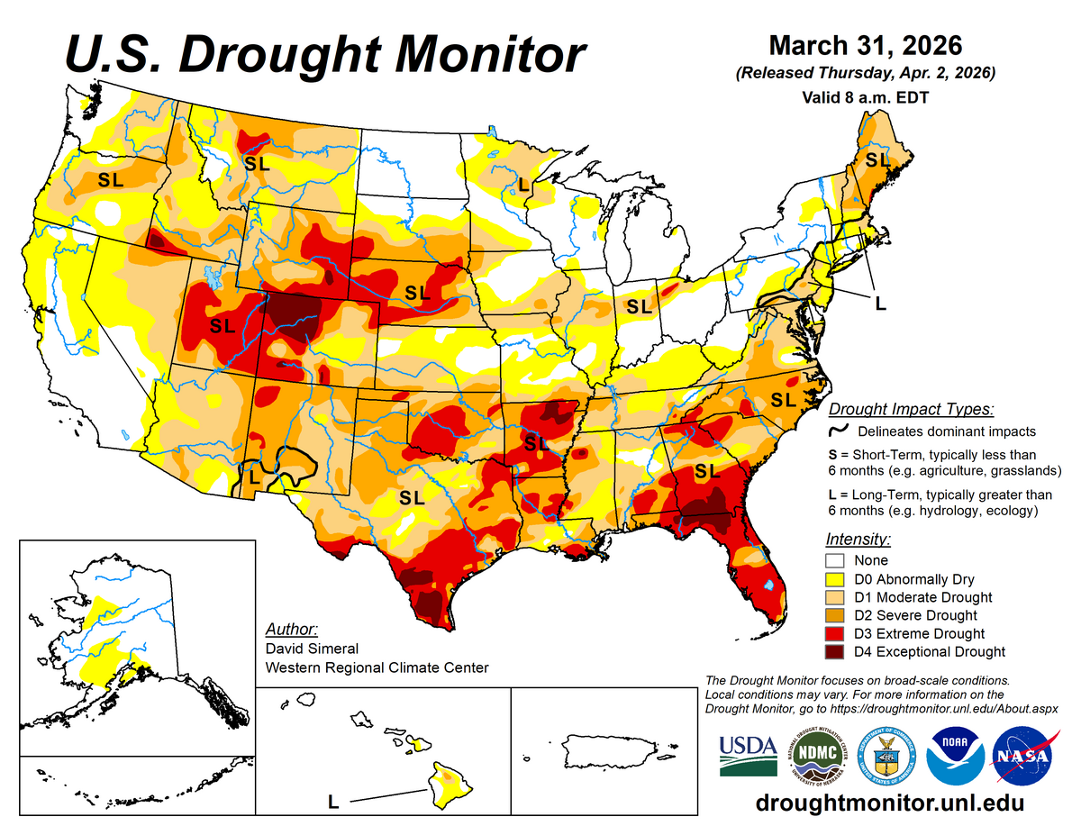
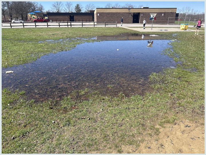
Mildly Wet conditions at Cheviot OH 3.4W.
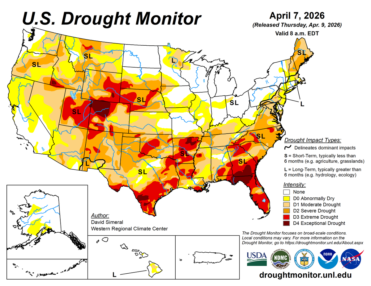
Widespread dry and drought conditions in the US, including from northern Indiana and Ohio southwest into Texas and the southwest, the south, the southeast a...
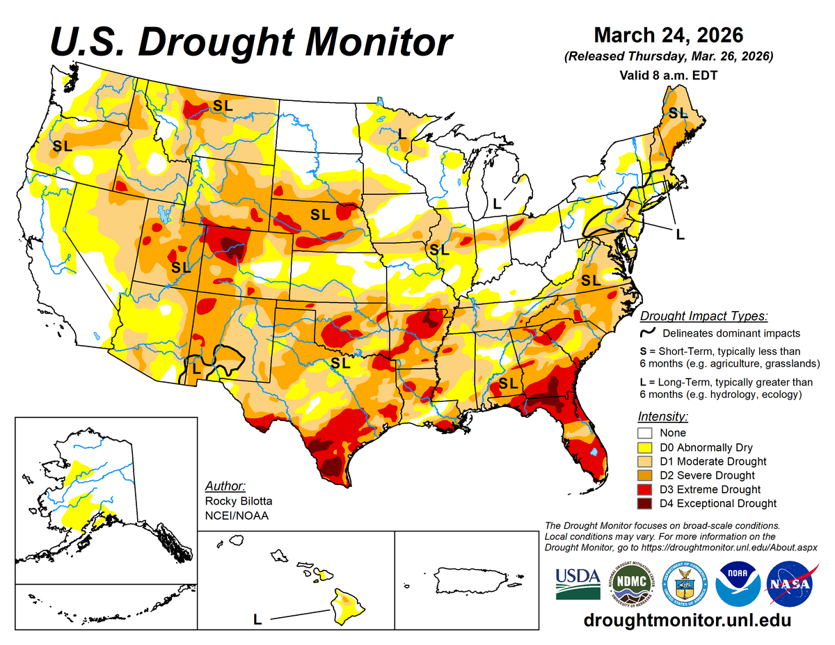
Mildly Wet conditions at Cheviot OH 3.4W.
Widespread dry and drought conditions in the US, including from northern Indiana and Ohio southwest into Texas and the southwest, the south, the southeast a...
Mildly Wet conditions at Cheviot OH 3.4W.
Widespread dry and drought conditions in northern Indiana and Ohio southwest into Texas and the southwest, the south, the southeast and Florida, the east co...