Conditional severe storm and flooding threat today
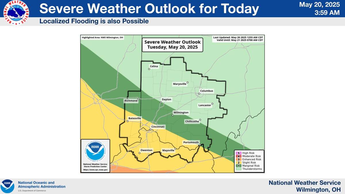
There is a conditional severe weather threat for the Cincinnati tri-state area today and this evening.
By far the greatest severe weather threat is to the south of Cincinnati. Severe storms, flooding, hail, and even an isolated tornado are possible in the Cincinnati metro area later today. The intensity of storms is going to be highly dependent upon how much destabilization can occur after the morning rains go through. There is a good chance that insufficient destabilization will occur to precipitate severe storms.
Unfortunately, a significant severe weather outbreak is expected South of Cincinnati. These are some of the same areas that got hit really hard on Friday.
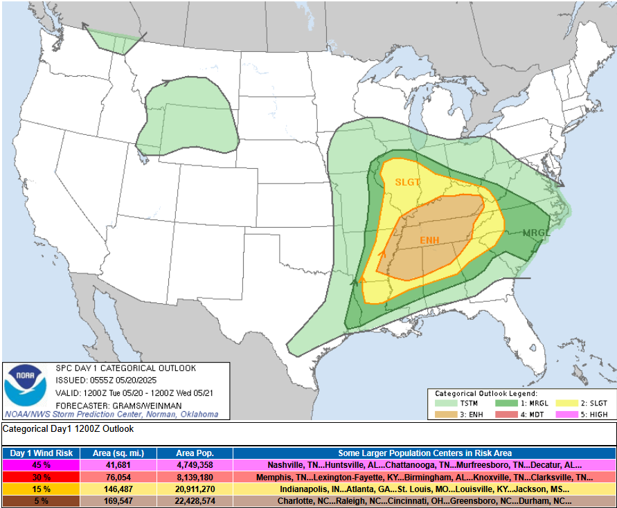
 Day 1 Convective Outlook
   NWS Storm Prediction Center Norman OK
   1255 AM CDT Tue May 20 2025

   Valid 201200Z - 211200Z

   ...THERE IS AN ENHANCED RISK OF SEVERE THUNDERSTORMS IN THE MID/DEEP
   SOUTH TO TN VALLEY AND CUMBERLAND PLATEAU...

   ...SUMMARY...
   Multiple rounds of severe thunderstorms are expected today through
   this evening, centered on the Mid/Deep South, Tennessee/Lower Ohio
   Valleys, and Cumberland Plateau. Tornadoes, some of which could be
   strong, along with scattered to widespread damaging winds, and large
   to isolated significant severe hail will be possible.
![]()